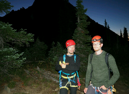
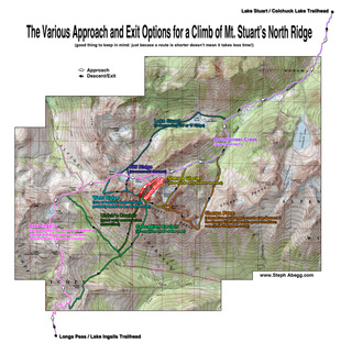
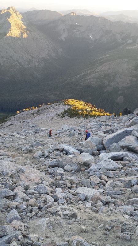
Having left the Bugaboos early due to bad weather, Nick seemed to have a hole in his heart where the summit of South Howser Tower should have been. It was unsurprising that his unfaltering summit lust was replaced by another massive objective on our way South: The North Ridge of Mount Stuart, in Washington State. And thus began the Choss Boys biggest epic to date. The Route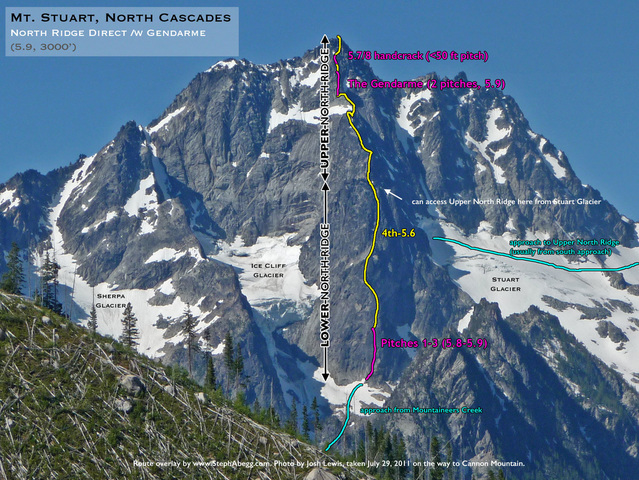 Credit: Steph Abegg, stephabegg.com The wonderful overlay above highlights the climbing portion of our adventure. We simulclimbed everything in yellow, as well as the first three pitches, and the handcrack just below the summit. Friday, September 9th, 2016Nick: Our earliest alpine start ever - 2:58 - was reluctantly agreed upon; it was an extra head start for the long day to come. We would need to be in bed by 9 PM to get 6 hours sleep, a bare minimum before a demanding adventure. Daniel and I racked climbing gear during the winding drive along Teanaway road – our access to the majestic alpine lakes wilderness area, where Mount Stuart is the centerpiece. After expeditiously preparing a curry supper, we were (miraculously) in bed by 9:30 PM. Despite the professional manner in which we prepared, I was feeling as nervous as I used to before cross-country ski races. I might have slept for 30 minutes all night. Based on constant rustling noises I heard, I’m guessing Dave and Daniel had similar luck. I had been vigilantly counting down the minutes for more than half an hour when the alarm finally sounded. 2:58 AM No breakfast, or at least that was the plan. Dave, the HEDONIST, started munching on granola bars and a banana, prompting Daniel and I to break our reserve and follow suit. We dressed, then hit the trail at 3:30 AM, the middle of the night. Right from the parking lot the hike was strenuous, slamming the cold shivers out of our bodies and sending us straight into a deep sweat. The headlamp beams prevented our eyes from adjusting to the oil-slick darkness. We could discern only one visual detail in the surrounding landscape: the horizon. It cut sharply into a blanket of endless stars that was draped over the invisible world around us.  Beautiful views right from the start of the approach... Dave took the lead for the first hour of the hike. He plowed into his dim bubble of headlamp light and I trailed at a pace that felt only slightly slower than running. I constantly planned three footsteps in advance, compensating for lapses in vision caused by veils of evanescent steam billowing out of my mouth. The only noises that I could hear over my panting breaths were the gentle tinkling of carabiners, and the crunch of our shoes on fresh frost.
I took the map too literally, and we soon found ourselves grunting through 5.9 moves to traverse the South-East side of the lake. The stars provided just enough light to illuminate gentle ripples on the inky water 50ft below us. After 15 minutes of tenuous “hiking,” we finally arrived at a terrifying down climb/butt slide that landed us on the flat shore of the lake. It was now 5:45 AM, and the sun had strayed close enough to the horizon that we could see the faint outline of the lake shore. Great timing. We Choss Boys had fortunately been desensitized to the disconcerting feeling of getting lost on approaches, and quickly forgot the short misadventure. Gradually, the most obvious contours of the horizon became visible and the landscape faded from pitch black to dark navy as we passed the North-East thumb of Lake Ingalls, traveling again on the proper path. Mount Stuart’s tremendous silhouette suddenly became visible to our right. 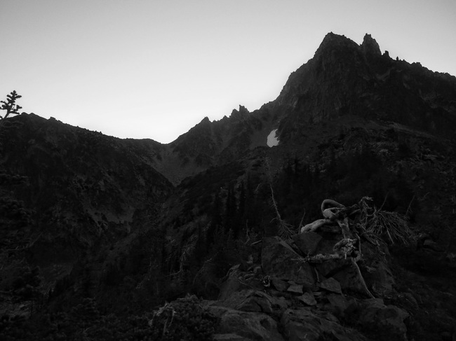 Mount Stuart at dawn, viewed from the South West The trail ascended to a prominent ridge at the very base of the mountain called Goat Pass. From our vantage point to the South-West, we could see the pass. The gentle pre-dawn light had finally revealed the surrounding landscape in a misty shade of pink. I will never forget the ensuing vista. 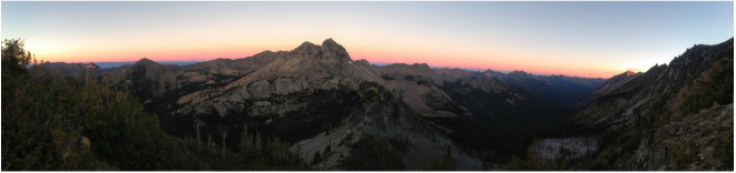 A sunrise view from Goat Pass centered on Mount Ingalls We climbed past the tree line, and suddenly a gentle breeze swept up from the adjacent valley, carrying faint scents of cedar and mountain flowers. As we scrambled up the final scree to the top of Goat Pass, the breeze became a gust, prompting us to cover our sweat soaked shirts (and pointy nipples) with layers long-since shed.
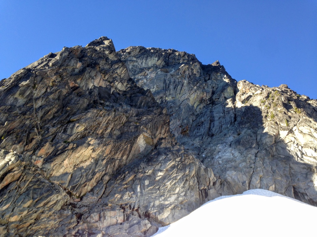
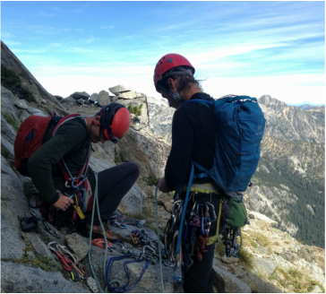
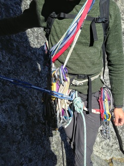
Instead, we found ourselves crossing yet another glacier without crampons completely hidden in the shadow of Mount Stuart, which stretched off to the Northern horizon; a deep chill set in. 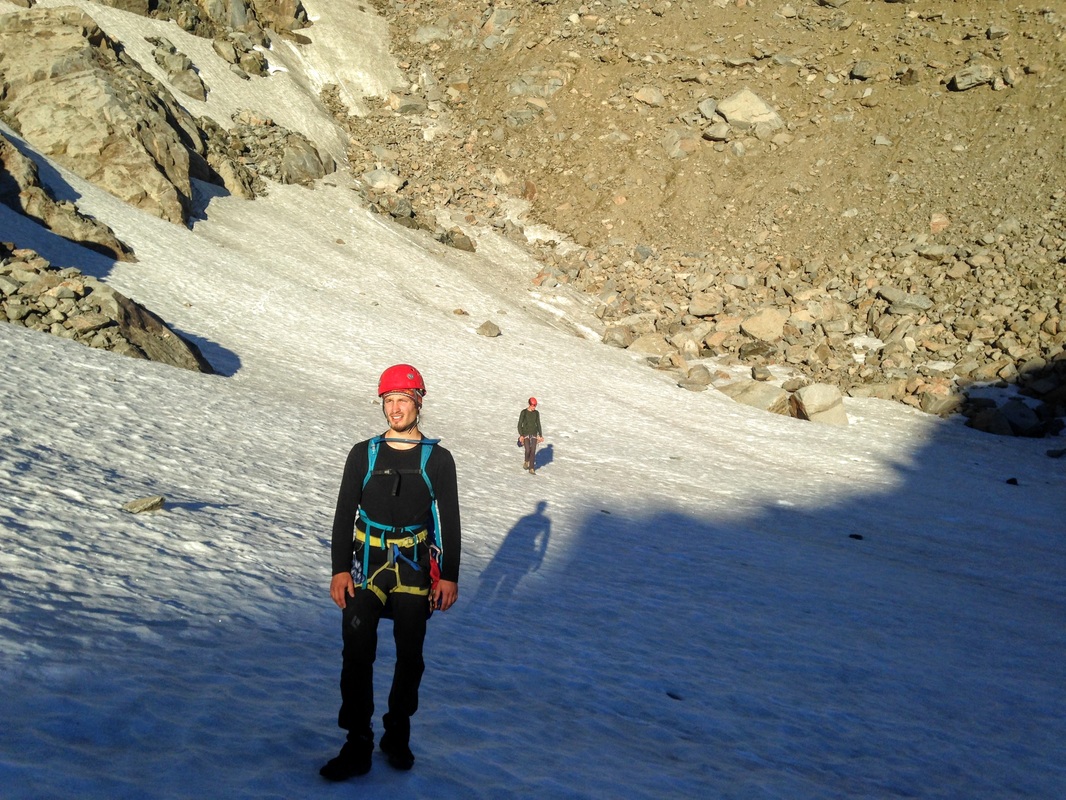 Stepping into the shadow of Mount Stuart It finally became apparent how masochistic our journey was. We had to hike 4 miles, ascending 3000 feet to the base of Washington’s second highest non-volcanic peak, and then skirt half of its circumference, simply to arrive at the most long and difficult route we could possibly climb to the summit. From the saddle of the North-West ridge, we descended 1000 feet that we had already gained, simply to reach the toe of the North Ridge. 8:30 AM Exhausted, sore, drenched in sweat, and parched, we scrambled the final 100 feet to the base of the route. The reward for our effort? This view of a jagged granite spine, stretching 3000 feet above us to the very summit of Mount Stuart (and some conservative sips of Gatorade). 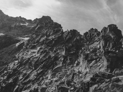 Mordor (as far as I could tell...) Mordor (as far as I could tell...) I felt no excitement, only dread. The crenelated black ridge looked like the ramparts of Mordor; an obstacle beyond human fabrication, and more massive than any mortal could hope to surpass. A discourging voice in my head seemed to be yelling in the early-morning silence. As I helped organize the simulclimbing system at the base of the first pitch, I made a concerted effort to remain hopeful. Rather than thinking of the endless terrain separating us from Wesley (and all of human civilization) I forced myself to think only of the nearest objective: the top of a 5.9 hand crack that marked the beginning of easy terrain where we could move quickly.
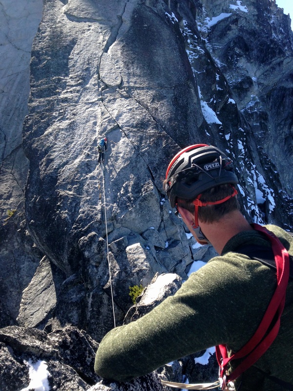
My tactic worked; soon enough we were cruising up easy climbing with the leader going 400-500 feet at a time, and my mind began to ease. Inevitably, the rope would often stretch around sharp blades of rock on the ridge crest, descend unprotected chimneys, round bulging corners, travel up slabs, and penetrate bushes, resulting in drag that slowed our progress considerably. Every few hundred feet, we would reach a relative high point on the ridge, only to find ourselves staring up at yet another 400 feet of climbing with no end in sight. Without fail, at every such occasion I would proclaim with certainty that the Great Gendarme “must be just over that next bulge!” Although the ridge appeared to be endless, I found myself really enjoying the experience. The climbing was consistently easy, but the stances on the ridge crest were thrilling. And the view... 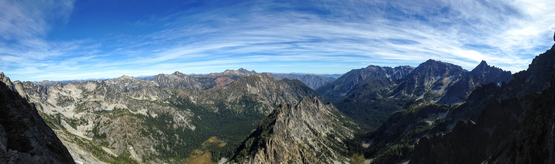 Many of the most exposed positions I have ever been in were along the 1600-foot stretch of ridge between the 5.9 hand crack and the Great Gendarme. Twice, the leader had to make an unprotected leap between two fins of rock at the apex of the ridge, with the precipice between the two falling more than 1000 feet. On several occasions we found ourselves traversing along bookshelf-sized hand rails with our feet smearing on featureless rock, looking down at an uninterrupted drop to the valley floor.
Wedged into a couloir between the flank of the North ridge and the Eastern expanse of the Stuart massif is a precipitous ice fall, aptly named “Ice Cliff Glacier.” As it melts and gradually creeps downhill, tremendous seracs constantly shift and fracture. Thunderous crashes echoed relentlessly through the East couloir as we approached the Gendarme, adding yet another dimension to the intimidation we were already feeling.
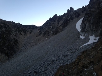
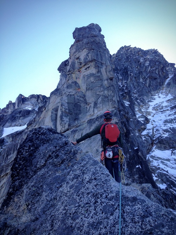
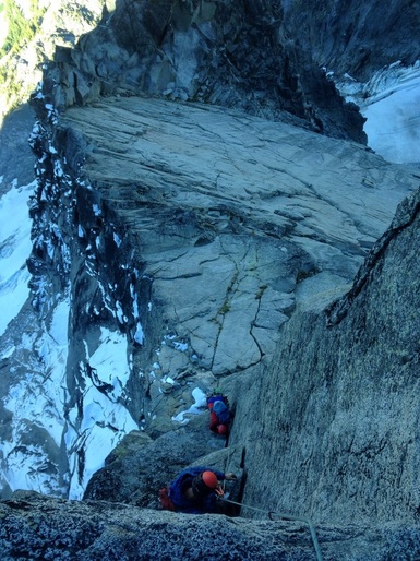 Daniel and Dave following the layback pitch Daniel and Dave following the layback pitch Once at the base of the tower, we stopped to put on our jackets and ate some canned apricots. I had long been inspired by the Gendarme, and asked if I could lead the first pitch, a 5.9 layback. It was a beautiful feature of rock, and despite the hours of exertion, I felt myself climbing with a steady flow and quickly approached the top of the pitch. Expecting to pull onto a large platform, I left a cam 15 feet below me and ran it out to the top of the pillar. Unfortunately, there was a nasty surprise awaiting me. I reached up over the lip, and rather than feeling a coarse granite surface, my fingers dug into an inch of something cold and granular. My luxo belay ledge was entirely covered in snow. My graceful top-out quickly shifted to a desperate belly flop and roll that left me completely covered in snow. Dave set out to lead the crux pitch, leaving Daniel and I shivering and huddled on the small platform. I could feel a severe chill creeping up from the snow through the thin suede leather of my climbing shoes to my bare feet within. 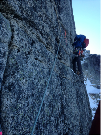 Traversing to the "Offwidth" crack. Traversing to the "Offwidth" crack. Dave: I had managed to heave myself up the long ridge of easy climbing, despite an incessant headache and queasiness. The pain in my knees on the endless approach had me worrying about whether I could negotiate the descent. Maybe we shouldn't have speed-walked the approach... The last part of the ridge had been spectacular, with perfect granite covered in easy handholds, but the obstacle ahead looked daunting. I asked Daniel how he was feeling, having not once heard any complaints, and he merely offered that his "Homeostasis was thrown off by the 2:58AM start"... He seemed to be toughing it out better than I was. Upon arrival at the base of the Great Gendarme, the snow caught me off guard – this was my first alpine climb, and somehow it never occurred to me that there might be snow on the route. After taking a break in the shade at the base of the tower, I lost balance on the first easy moves (on top-rope nonetheless) – a combination of the slickness of the cold rock and my perturbed mental state. After pulling the rest of the pitch and rolling onto the snow-covered pedestal halfway up the Gendarme, it was my lead. A 5.9 offwidth, by some accounts the crux of the route, separated us from the remainder of the easy ridge climbing to the top. The crack is not visible from the belay, so the unknown nature of the width and length of the crack added to my fears. I remembered a debate on this route's page on Mountainproject.com about the necessity of a #4 camalot on this pitch, with some commenters saying that it was necessary. This cam was notably absent from our gear as I racked up for the pitch. Next time I will be more involved in the packing process. I donned my warmest jacket and started the steep traverse to the crack. My fears instantly dissipated as I looked up at the crack. The difficult section was clearly no more than 15 feet long, and it looked like the cams I had would fit most of the way. After some pleasant and straightforward fist jamming, I reached the end of the difficulties and cruised up the rest of the crack. I felt better than I had all day, with the crisp alpine air keeping me at a comfortable temperature. This was my first offwidth experience where I didn't end up drenched in sweat and/or bleeding. Bringing Nick and Daniel up to the snow covered belay, it was my lead again, to hopefully finish the last ~500 feet of climbing, and reach the summit. Unfortunately, the feelings of nausea came back with a vengeance. Altitude sickness? As I set off over the ridge I encountered severe rope drag and trudged through shin deep snow in my climbing shoes. After a few hundred feet, I was very much ready for the end. Some bizarre down-climbing on particularly dubious rock features led to snow-covered talus scrambling where Daniel dislodged a large block as he was following. Shaken up by the rock fall, with no gear left to negotiate a steep section, the brutal cold had worn me down to the point where I had to stop, still with no end in sight. Nick jumped on the lead with inexplicable vigor (summit fever...) and blasted up the ridge as Daniel and I shivered miserably in a snow bank. He disappeared out of sight, and we soon heard the exact words we wanted to hear: "GUYS, I'M AT THE SUMMIT!". Fumbling and shivering my way up the last couple of moves, I flopped onto the summit. A splash of sunlight relieved my shivering, but further exacerbated my headache and nausea. At the peak of my misery, I grumbled to Nick and Dan that I didn't even care about hitting the summit and just wanted to leave. After walking up to what looked like the highest point, I took a half-assed look for the summit register. "Fuck it," and I went back to the bags to start sussing out the complex descent, which looked improbable from our perch. 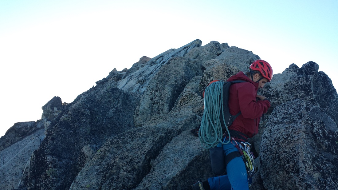 One of few summit shots that I took. We ate a couple Clif bars and drank the last few sips of water we had rationed. I guess it was pretty spectacular up there... I felt a little better. Unfortunately, our haste on the approach cost us – our plan to drink lots of water on the way to Ingalls lake and refill our jugs had been completely forgone in the rush. We consequently drank on the climb and were paying the price. This, and my unrequited caffeine dependence certainly diminished the experience of topping out the longest climb of my life. 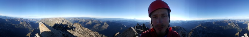 Daniel looking somewhat dazed on a summit panorama. 6:20 PM Neither Nick's optimistic estimate of hitting the summit at 3:00 PM nor my more cautious guess of 5:00 PM were conservative enough; we topped out at 5:50 PM. After a slight recovery, I began leading the way down. The descent route takes a long path through the "Cascadian Couloir." We scoffed at purported "False Cairns" leading into an Ulrich's Couloir, a trickier route often taken by climbers that think it's the Cascadian Couloir. As we hit the false summit, we scanned our surroundings for rock cairns leading the way, as the Cascadian Couloir was said by online sources to have many. We managed to spot a small one and off we went. Some tenuous downclimbing and scrambling with very few cairns led us to a steep section of rock that could only be negotiated by confronting a steep snow field. Nick proposed that we cross it and descend scree on the other side, but having never done anything like this, and not having crampons, I opted for a more secure descent at the boundary of the field, where the snow and the cliff made a small chasm. Daniel, then Nick followed suit. We scrambled down more or less securely until a cake-sized (food was definitely on my mind) block was dislodged from above. I braced myself as it hit me square in the bicep. It didn't bother me much, I was devoid of most feelings at the time and had trouble stringing together a coherent sentence. I plowed forward in a zombie-like state.
It was here that Daniel's "abstemious" nature truly surprised me. We had brought water purification tablets for drinking stream water. Unfortunately, these needed to be left in the water for 30 minutes before we could drink it. Despite hearing horror stories of stomach parasites contracted by drinking unfiltered stream water, Nick and I happily guzzled the water without using the tablets. Only Daniel meticulously purified the water with the tablets and proceeded to waited for exactly half an hour before consuming. I was mystified that anyone could have this level of self control. We checked our location on the GPS, and it looked about right when compared with a map. I suggested the possibility of sleeping in the woods, but the decision was made to press on. At this point the trail looked a little bit clearer. I shifted into auto-pilot and plowed forward with my head down... Daniel: I curiously observed Nick and Dave frantically acquiring water, and realized they must have been quite thirsty. I felt thirst as well, but the feeling was not a priority in my mind and therefore not important. The plan had always been to hike back to the van in the dark. We knew the hike would take about two-and-a-half hours from the base of the couloir. However, we foolishly neglected to anticipate that the darkness would impede our path-finding abilities. When night fell, we became inexplicably tense. The complete inhibition of peripheral vision forced our eyes to focus on the small circles of pale light from our headlamps. The darkness seemed to devour my light because my headlamp was far weaker than Nick or Dave's. Our acutely attuned ears perked with every nocturnal creak and chirp from the black aether beyond. 9:00 PM After 18 hours of strenuous hiking and climbing, we were following overgrown trails in the valley. We hesitated upon encountering a fork in the path. Despite breaking out our phones and looking at our map, we were still unconvinced about which direction to pursue. We found a trail that presumably led to a landmark at the base of the valley: Ingalls Creek. Reaching the creek as planned boosted our path-finding confidence and we persisted along this trail with aplomb. Switching leaders periodically, we made striking progress in the next couple hours. Our pace was relentless and our rests were brief. The dogged stride was fueled by the imminent arrival to our van and the comfortable beds within. 10:30 PM At a certain point, we became painfully aware that the path we were on was not continuing in the right direction, and that we should have already reached Wesley. Dave's exhaustion delayed his acceptance of this fact, so he quietly sat down to rest while Nick and I started figuring out what to do next. Walking an unknown distance back the way we came in search of turn-off we had missed was unduly daunting. Instead, we settled on continuing in the wrong direction because our phone GPS suggested that the trail might join up with with mountain road our van was parked on.  The view approaching Ingalls Creek. A view the Choss Boys never encountered due to total darkness and being in completely the wrong place. (credit: http://www.davidjamie.com/2012/stuart.html) The next two hours of walking was completely physically and mentally draining. We had almost forgotten about the searing joint and muscle pain in our legs because our perceived proximity to the van. Now, our body agony returned with a vengeance. The dense forest trail kept our broken spirits questioning whether it would lead to the main road at all. Reaching the main road brought us profound relief because we were 100% sure it would lead us home. Unfortunately, we were still 10 miles downhill from the van. Nick wearily collapsed in the grass. Dave joined him and remembered his hunger. We ate some nuts and raisins, drank some water, and I urged that we walk a little further. The plan was to find a spot to lay down for the night and hitch a ride to our van in the morning. We dragged our feet the next few kilometers convinced it would be the last of our walking. Saturday, September 10th, 201612:30 AM We found a grassy area by the road, and prepared our bivy to wait out the night. We flaked out the rope for a mattress, put on all our layers, and tried to get some rest. As uncomfortable as it was, we were relieved to give our whipped bodies repose. In no time, it became much colder since we weren't moving. The rope offered little protection from the frigged ground. Unable to sleep, we suffered in silence. Before long, Nick's near-pneumatic suffering became too much to bear. His clothing was more suited to blocking heavy alpine winds than insulating against the bitterly cold ground. "I can't do this. We can't stay here. We have to keep moving." Nick urged us this time. We finally decided to trudge the last 7 miles uphill to the van. 3:30 AM The next three hours of plodding was nothing like any of us had ever experienced: excruciating pain, extreme fatigue, and a complete lack of mental control. Dave was in the most pain. His lifelong knee problem was the worst it had ever been, and his awkward limping made it seem like his leg was made of wood. I was a robot, mindlessly moving each leg in succession. At every bend in the road, Nick somehow convinced himself it was the last. With every turn, he became increasingly frustrated to discover it was not. A violent inner struggle was going on in Nick's head as the crunch of feet on the gravel broke the silence of the night. 6:30 AM After an impossible number of bends in the road, we finally arrived at the parking lot: 27 hours van-to-van. Aftermath: "Ultimate Shit-Show Epic" were Nick's words upon re-entering the van. And that it was. Hikers were starting to trickle into the parking lot as we searched for our celebratory bottle of wine - a $2.99 "blend" that we bought at a bargain grocery outlet. We didn't have a bottle opener, so we stabbed the cork with a Leatherman until wine erupted from the top. The wine had a "complex" taste, somewhere between grape juice and vinegar. We drank it through our teeth to strain the bits of cork out. After choking down a few mouthfuls, we decided it was best saved for cooking. We slept in until 12 PM and drove until we could find a coffee shop for an internet binge. Over the next few days we began to piece together exactly what happened on Mt. Stuart. As it turns out, we didn't even descend the Cascadian Couloir, but entered Ulrich's Couloir after all. This wasn't so bad, but led to us crossing over the main trail at some unknown point and then taking our final detour. It turns out we added 15 km to our journey, effectively doubling the hiking distance required for the entire journey. 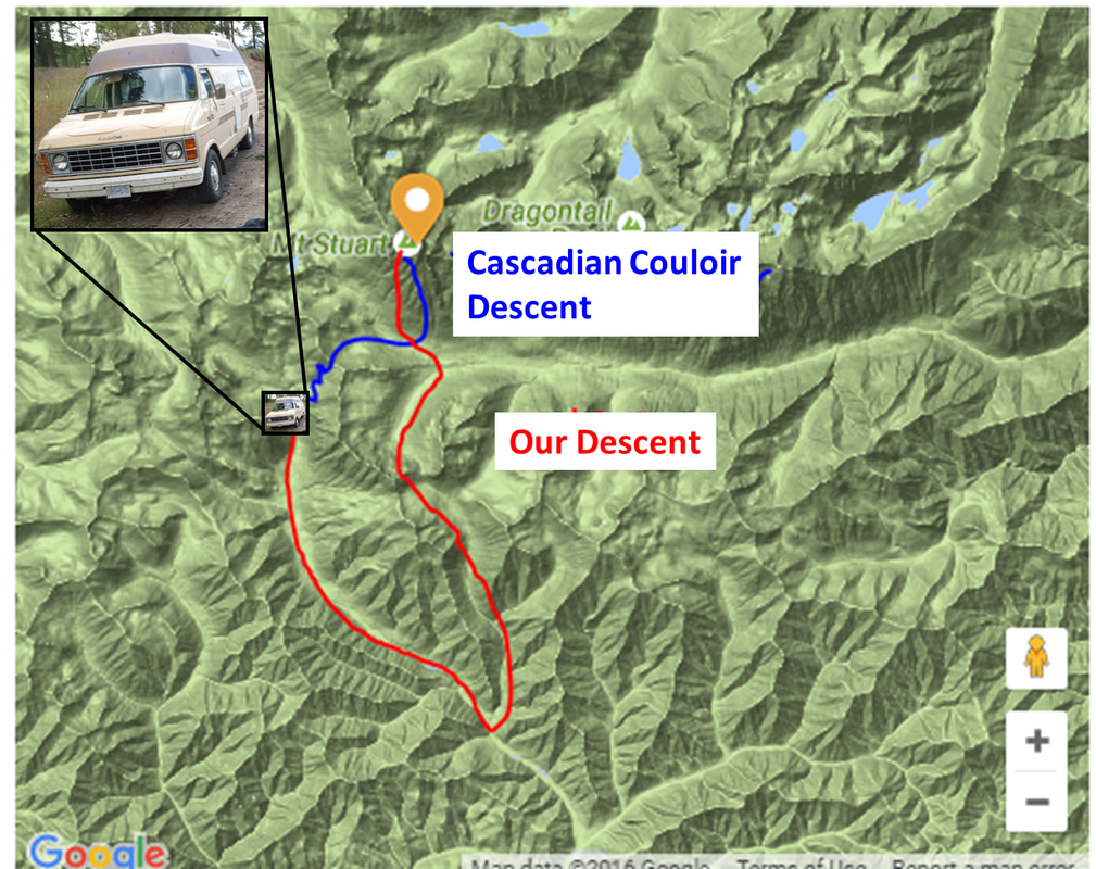 Regular (Cascadian Couloir) Descent vs. Our Descent Mount Stuart was the biggest Choss Boys epic yet. Though no grave danger was encountered, lots of lessons were learned:
-Nick, Dave, and Dan
7 Comments
Hubert Alacoque
9/28/2016 04:24:28 pm
Amazing adventure, amazing story !!! What endurance !! Impressive indeed !
seamus b-p
9/28/2016 05:55:43 pm
Nice! Now you know how the ends of those long runs feel! Haha
marie wadden
9/28/2016 08:07:14 pm
OMG You guys are some tough. I have to say the hiking appeals more to me than the climbing. The dizzying heights would defeat me. The flat ground would be a relief.
Megan
9/29/2016 05:35:22 am
BOYS! What an adventure! This piece was quite the read, thanks for allowing us to be part of it. YOU GOOFS!!! My favourite post yet... But plz be more careful hahaha
Hubert Alacoque
9/29/2016 10:57:56 am
Your story compares with the story from Michael Crichton, famous american author, whom in his book called Travels, related his personal experience in climbing the Kilimanjaro. I remember his story vividly. He describes the approach to the climb to be longer and more strenuous than expected, the climb to be more difficult than expected, the time at summit too short because they were going to run out of time for the descent. And interestingly, the descent was gloomy somehow, instead of the exhilaration and the satisfaction of the great achievements. He also relates seeing and talking to climbers who came back in that mental state... I would think it all comes from the mental and physical exhaustion of the entire experience. 9/30/2016 10:41:04 am
Such adventurous souls you have So happy you pulled out of that one; there were so many opportunities where due to exhaustion, your stories might have had a different ending. Great writing, Thank you for the updates.
Skye
10/2/2016 05:25:14 am
Crazy adventure dudes. Glad you all pulled through!!! The map is a nice touch... wow 😳 Leave a Reply. |
Categories
All
AuthorsWe are Daniel, David, Nick & Erik. EMAIL UPDATESKeep up to date with our adventures! Subscribe below to get an email for each new blog post.
Archives
October 2020
|
 RSS Feed
